

eTrex® Touch


eTrex® Touch
Overview
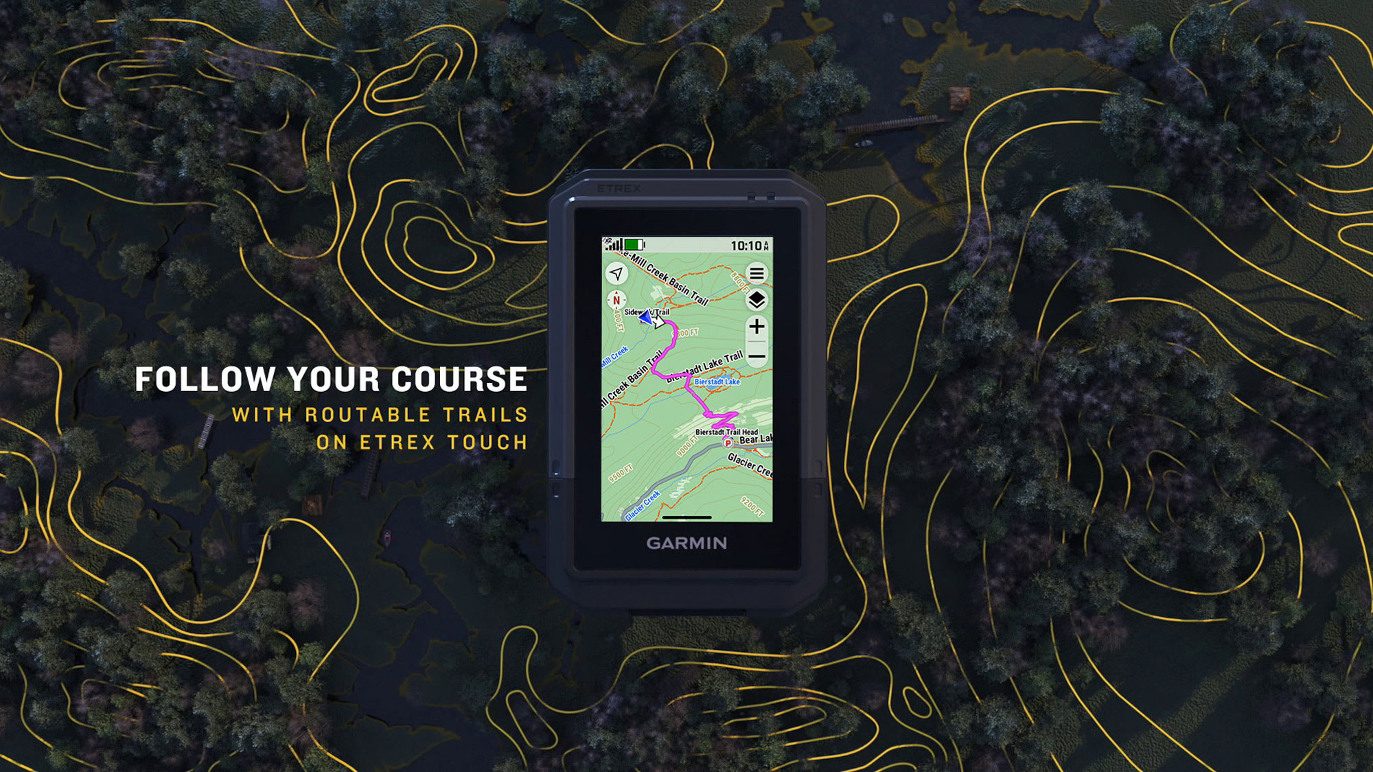
TAP INTO ADVENTURE
This essential, simple-to-use touchscreen GPS handheld offers preloaded TopoActive maps with routable trails and roads for your outdoor adventure. Plus, the durable design and long battery life help you enjoy all your activities even more.
SWIPE AND ZOOM ON A BRIGHT 3-INCH TOUCHSCREEN
PRELOADED MAPS FOR ROADS AND TRAILS
LONG BATTERY LIFE OF UP TO 130 HOURS IN GPS MODE
PLAN AND REVIEW TRIPS WITH THE GARMIN EXPLORE™SMARTPHONE APP
BUILT TOUGH (MIL-STD 810) AND WEATHER-RESISTANT (IP67)
OPTION TO PURCHASE AN OUTDOOR MAPS+ PLAN FOR PREMIUM MAPPING
WHAT YOU'LL LOVE
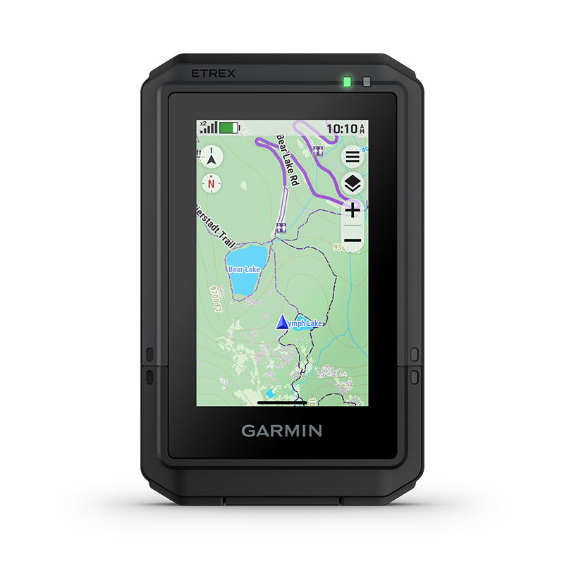
TOUCHSCREEN
The slim, pocket-size handheld navigator features a bright 3-inch high-resolution color touchscreen so you can easily swipe and zoom to follow your route.
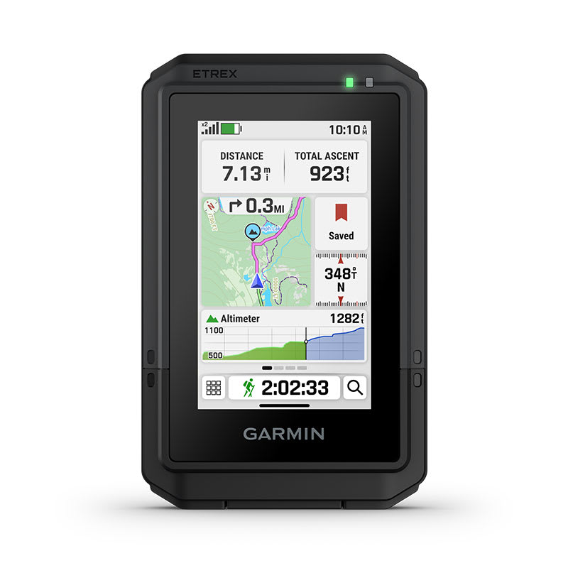
RUGGED DESIGN
The eTrex Touch navigator is purpose-built with an IP67 water rating and impact-resistant (MIL-STD-810) design to withstand weather and rugged conditions.
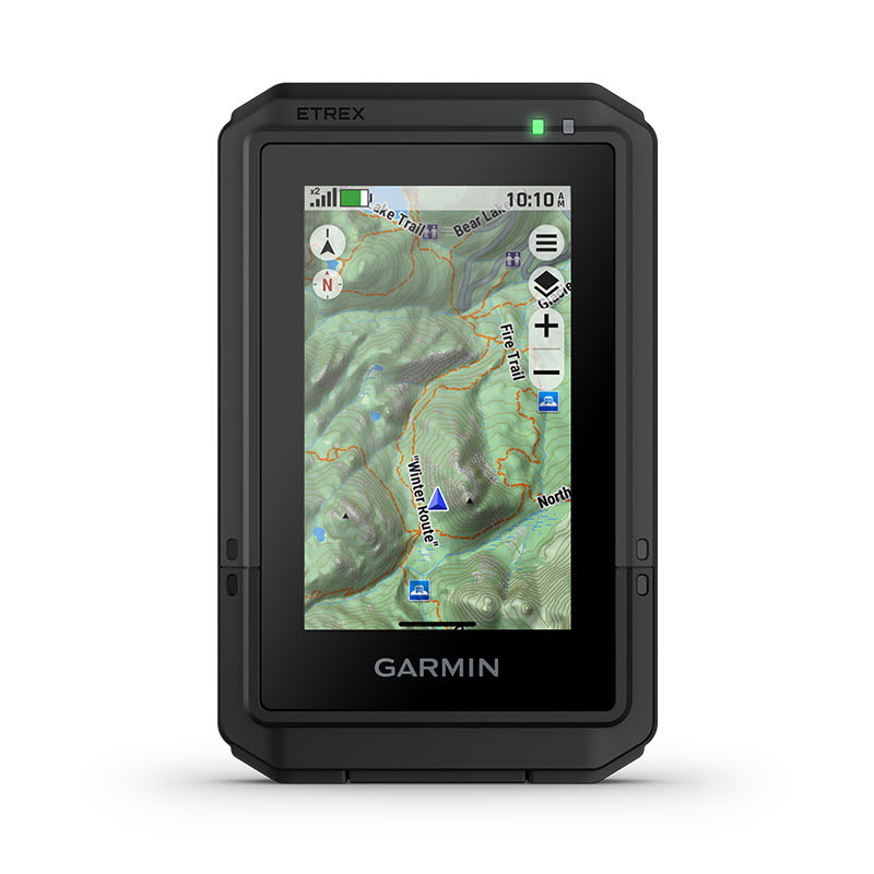
PRELOADED MAPS
View detailed TopoActive maps for roads and trails, and see terrain contours, topographic elevations, summits, parks, rivers, lakes and geographical points plus thousands of points of interest. Plus, get easy access to additional TopoActive mapping around the globe.
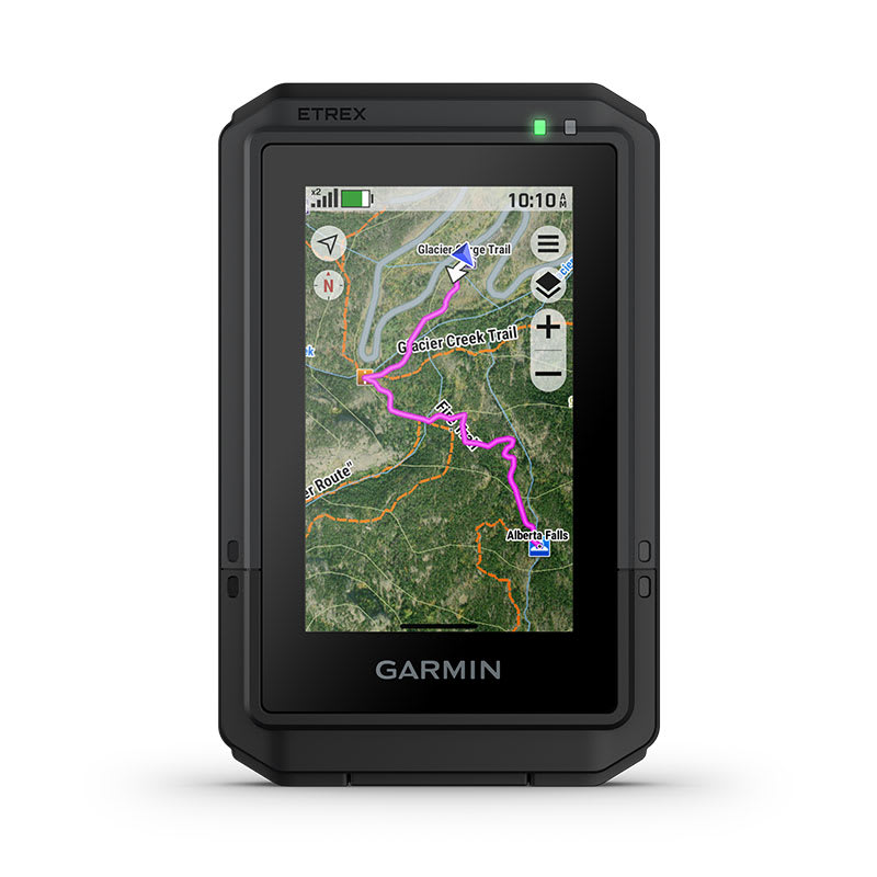
OUTDOOR MAPS+
Purchase a subscription to Outdoor Maps+ for ongoing access to a wide variety of premium mapping content, including satellite imagery, campgrounds and more. Download and receive automatic updates via Wi-Fi® technology.
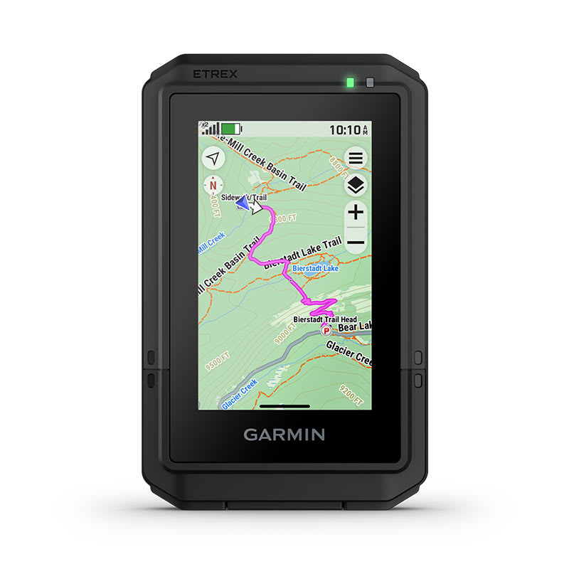
PLAN AND REVIEW YOUR TRIP
Connect with the Garmin Explore app to plan and review trip data on your smartphone or tablet and manage your waypoints, courses and activities.
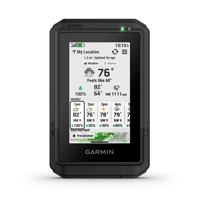
WEATHER
Get real-time forecast information so you are aware of the changing conditions. This feature requires an active internet or Wi-Fi connection, or use of the Garmin Explore app on your paired smartphone.
MORE OUTDOOR FUN. AT YOUR FINGERTIPS.
ADVENTURE FEATURES
BATTERY LIFE
Get long battery life up to 130 hours in all satellite systems plus multi-band mode, assuming typical use with SatIQ™ technology; and up to 650 hours in expedition mode.
GPS ACCURACY
Know where you are with multi-band GPS and multi-GNSS support, which gives you access to multiple frequencies sent by navigation satellites for superior position accuracy.
FIND NEW DESTINATIONS
Popularity routing helps you navigate the best routes and rides. Round-trip routing allows you to enter a distance you want to travel for route suggestions that will bring you back to where you started.
ASCENT PLANNING
See upcoming climbs on your route, when they will occur and how steep they will be.
DIGITAL COMPASS
Follow your bearing on the digital compass, which provides an accurate heading even when stationary.
GEOCACHING
Get cache updates from Geocaching Live, including descriptions, logs and hints. When connected to the Garmin Explore app on your compatible smartphone, each find will upload to your geocaching.com profile.
GARMIN SHARE
Easily share saved locations and courses with friends' compatible Garmin devices.
ON THE GO
This device has an integrated Spine Mount 2 and is compatible with additional accessories, sold separately.
Maps
Maps for New Regions
Need maps for regions other than the ones that came on your device? See all maps that are compatible with your device.
Need a map update?
Update the maps that came with your device for the best navigation experience.
Check for Updates
In the Box
- eTrex Touch GPS handheld navigator
- Charging/data cable
- Documentation
Specs
General | |
| Lens material | chemically strengthened glass |
|---|---|
| Dimension | 2.6" x 4.15" x 0.97" (66 mm x 105.4 mm x 24.6 mm) |
| Weight | 5.3 oz (150 g) |
| Water rating | IP67 |
| Touchscreen | yes |
| Display Type | 3" transflective Color TFT |
| Display Size | 1.53" x 2.55" (3.88 cm x 6.48 cm); 3" diag (7.62 cm) |
| Display resolution | 240 x 400 pixels |
| Battery Type | rechargeable, internal lithium-ion |
| Battery life |
All Satellite Systems + Multi band: Up to 130 hours* *Assuming typical use with SatIQ technology |
| Memory/History | 32 GB (user space varies based on included mapping) |
| Interface | USB-C |
Maps & Memory | |
| Preloaded maps | yes (TopoActive, routable) |
|---|---|
| Ability to add maps | yes |
| Basemap | yes |
| Automatic routing (turn by turn routing on roads) for outdoor activities | yes |
| Map segments | yes (15,000) |
| Satellite imagery | yes (via Outdoor Maps+ subscription) |
| Includes detailed hydrographic features (coastlines, lake/river shorelines, wetlands and perennial and seasonal streams) | yes |
| Includes searchable points of interests (parks, campgrounds, scenic lookouts and picnic sites) | yes |
| Displays national, state and local parks, forests and wilderness areas | yes |
| Waypoints | yes |
| Courses | unlimited |
| Activities | unlimited |
| Activity profiles | yes |
| GPX imports | yes |
Sensors | |
| GPS | yes |
|---|---|
| GLONASS | yes |
| Galileo | yes |
| QZSS | yes |
| BeiDou | yes |
| IRNSS | yes |
| Barometric altimeter | yes |
| Compass | yes |
| High-sensitivity receiver | yes |
| GPS compass (while moving) | yes |
| Multi-band frequency support | yes |
Daily Smart Features | |
| Connect IQ™(downloadable watch faces, data fields and apps) | yes |
|---|---|
| Smart notifications on handheld | yes |
| Weather forecasts | yes |
| Weather | yes |
| Pairs with Garmin Connect™ mobile | yes |
| Garmin Share | yes |
| Passcode | yes |
| Next Word, Auto Complete, Auto Correct | yes (Auto Correct, Next Word, Auto Complete) |
Safety and Tracking Features | |
| LiveTrack | yes |
|---|---|
Tactical Features | |
| Compatible with AB Quantum - Garmin | yes |
|---|---|
| Ballistics solver | yes (unlock required) |
| Dual grid coordinates | yes |
| Night vision mode | yes |
Outdoor Recreation | |
| Area calculation | yes |
|---|---|
| Sun and moon information | yes |
| Geocaching-friendly | yes (Geocache Live) |
| Custom maps compatible | yes (500 custom map tiles) |
| Picture viewer | yes |
Mapping & Navigation | |
| Point-to-point navigation | yes |
|---|---|
| TracBack® | yes |
Outdoor Applications | |
| Compatible with Garmin Explore™ app | yes |
|---|---|
| Garmin Explore website compatible | yes |
Networking & Connections | |
| Wireless Connectivity | yes (Wi-Fi®, BLE, ANT®) |
|---|---|