

Alpha® XL


Alpha® XL
Overview

TRACK YOUR PACK FROM YOUR TRUCK
For hunters who want to track, monitor and retrieve their dogs from the field, this rugged dog tracking GPS navigator can handle off-road terrain while following up to 20 dogs1 on its big, easy-to-read display.
CRISP HIGH-RESOLUTION 10-INCH TOUCHSCREEN
PAIRS DIRECTLY TO YOUR COMPATIBLE GARMIN DOG COLLARS AND HANDHELDS
TRACK UP TO 20 DOGS, SHOWING DISTANCE, DIRECTION AND STATUS FOR EACH
NAVIGATE YOUR HUNT WITH GARMIN MAPPING FOR ON- OR OFF-ROAD
DELIVER COMMANDS TO PAIRED DOG COLLARS VIA THE TOUCHSCREEN
CHANNEL VIEW FEATURE HELPS AVOID FREQUENCY CONGESTION
WHAT YOU'LL LOVE
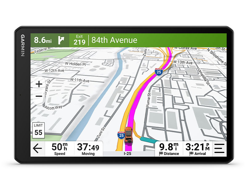
BIG, EASY-TO-READ DISPLAY
An extra-large 10-inch capacitive touchscreen provides a crisp high-resolution display for easy readability while driving.

TRACK YOUR PACK
Monitor up to 20 dogs with your compatible dog collars — from up to 9 miles away — on the color touchscreen map display. Unit is backward compatible with select Garmin collar devices, so you can track with existing equipment.

COMMAND CENTRAL
The unit's large touchscreen lets you deliver training commands — from 18 levels of stim, tone and vibration— to your paired collars, enabling quick adjustments for individual dogs.
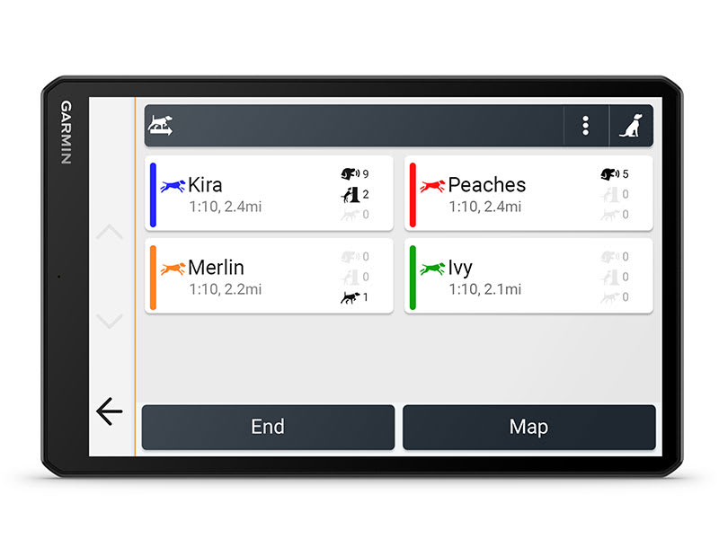
HUNT METRICS
See each dog's daily hunting patterns, distance, speed and time afield, so you can monitor performance1.
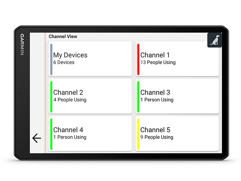
CHANNEL VIEW FEATURE
Monitor the concentration of collars in the area, and easily select less congested channels to avoid interference.
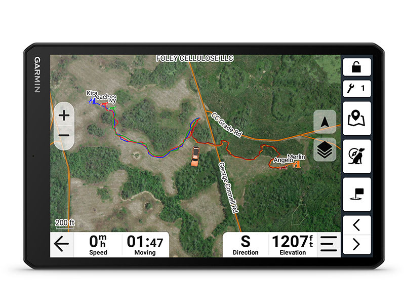
SATELLITE IMAGERY
Download satellite imagery to your device via Wi-Fi® technology, and see the terrain features from above to help you navigate or find suitable habitat for your quarry.
CONNECT WITH YOUR DOGS ON THE RUN
HUNTING/TRACKING FEATURES
IN-VEHICLE TRACKING
View dog positions overlaid on topo contours or satellite image views.
WIRELESS CONNECTION
Tracker works on or off the in-vehicle dock — connecting wirelessly within 10' for up to 2 hours.
18 LEVELS OF TRAINING
Customize commands with momentary and continuous stim plus different levels of tone or vibration.
ALPHA® APP
Pair with the Alpha smartphone app to see and save real-time dog tracking data.
DOG LIST/GROUP MANAGEMENT
Store up to 250 dogs in your list, and manage active groups.
PRO VIEW COMPASS
Display shows which direction and how far away dogs are — and when a dog is “treed” or “on point.”
COLLAR MONITORING
See battery level, communication state and more for paired collars.
LOCATION AND GEOFENCING ALERTS
Know where your dogs are, and get an alert if they move outside a designated area1.
DEVICE INTEGRATION
Enjoy wireless connectivity with a full range of compatible Garmin handhelds and dog collar devices.
BACKWARD COMPATIBLE
Easily pair the device to select T and TT™ series collars.
NAVIGATION FEATURES
MULTI-GNSS SUPPORT
Access multiple satellite systems to track your pack in more challenging environments than GPS alone.
MAPS FOR ON- AND OFF-ROAD
Get topo and street maps of North America, U.S. Forest Service roads and trails, and more.
TOPOACTIVE MAPS
See terrain contours, elevations, summits, parks, coastlines, rivers, lakes and more.
ABC SENSORS
Outdoor sensors include altimeter, barometer and 3-axis electronic compass for rugged-terrain guidance.
OUTDOOR MAPS+
Subscribe to Outdoor Maps+ to view public land information, enhanced topo maps, landowner names and more2.
- Requires compatible dog collars (sold separately)
- Wireless internet connection required
Maps
Maps for New Regions
Need maps for regions other than the ones that came on your device? See all maps that are compatible with your device.
Need a map update?
Update the maps that came with your device for the best navigation experience.
Check for Updates
In the Box
- Alpha® XL dog tracking GPS navigator
- Rugged suction cup with powered VHF mount
- Socket arm and 1" ball mount
- 16” (40.6 cm) magnetic mount antenna
- Vehicle power cable
- Charging/data cable
- Documentation
Specs
General | |
| Dimension | 9.65" W x 6.06" H x 0.83" D (24.5 x 15.4 x 2.1 cm) |
|---|---|
| Weight |
Total: 28.5 oz (806 g) Head Unit: 19.5 oz (554 g) |
| Display Type | 10.1" wide view IPS, color TFT, with on-lens capacitive touch panel |
| Display Size | 8.5" W x 5.3" H (21.6 x 13.5 cm); 10.1" (25.7 cm) diagonal |
| Display resolution | 1280 x 800 pixels |
| Dual-orientation display | yes |
| Magnetic Mount | yes |
| 1" ball adapter with AMPS plate | yes |
| Battery Type | rechargeable lithium-ion |
| Battery life | up to 2 hours |
Maps & Memory | |
| Data cards | microSD™ card (not included) |
|---|---|
| Preloaded street maps | yes |
| High Definition 3D terrain | yes (Outdoor Maps+ Subscription) |
| 3D Terrain | yes (Outdoor Maps+ Subscription) |
| Internal storage | 64 GB |
| Ability to add maps | yes (Outdoor Maps+ Subscription) |
| External memory storage | microSD™ card (not included) |
| Includes map updates | yes (Outdoor Maps+ Subscription) |
| Downloadable Satellite Imagery | yes (Outdoor Maps+ Subscription) |
| TOPO map support | yes (Outdoor Maps+ Subscription) |
| Downloadable USGS Quad Sheets | yes (Outdoor Maps+ Subscription) |
Sensors | |
| GPS | yes |
|---|---|
| Galileo | yes |
| Barometric altimeter | yes |
| Compass | yes (when out of mount) |
| 10 Hz multi-GNSS positioning | yes |
Outdoor Recreation | |
| Preloaded topographical maps | yes |
|---|---|
| Preloaded US public land boundaries | yes |
| Preloaded private land parcel maps | yes (parcels greater than 4 acres) |
| Preloaded USFS Roads and Trails, including motor-vehicle-use-maps for motorcycle, ATV, SXS and full-size 4x4 | yes |
| Navigate-a-track navigation | yes |
| Turn-by-turn trail navigation | yes |
| Compatible with Outdoor Maps+ Subscription | yes |
Mapping & Navigation | |
| Point-to-point navigation | yes |
|---|---|
Camera Features | |
| Backup camera compatible | yes (BC 50) |
|---|---|
Navigation Features | |
| Garmin Real Directions™ landmark guidance | yes |
|---|---|
| TripAdvisor® Traveler Ratings | yes |
| Route shaping through preferred cities/streets | yes |
| Includes traffic | yes (with Alpha Mobile app) |
| Lane assist with junction view (displays junction signs) | yes (with Alpha Mobile app) |
| Bluetooth® pairing | yes |
| Speed limit indicator (displays speed limit for most major roads in the U.S. and Europe) | yes |
| Driver alerts for sharp curves, school zones, red light and speed camera warnings and more | yes |
Advanced Features | |
| Smart notifications via app | yes |
|---|---|
| Wi-Fi® map and software updates | yes |
| Access to live services via app (traffic, weather, etc.) | yes |
Connectivity | |
| Smartphone platform compatibility | iPhone®, Android™ |
|---|---|
| Works with Garmin app on a compatible smartphone | yes (with Alpha Mobile app) |
| Range (via smartphone or other Bluetooth® source) | 30 ft (10 m) |
Motorcycle Features | |
| Garmin Adventurous Routing™ | yes |
|---|---|
| Track support | yes |
| Custom map support | yes |
| Wireless ANT+® technology | yes |
Adventure Features | |
| Pair with compatible inReach® devices | yes |
|---|---|
| Track recorder (breadcrumbs) | yes |
| iOverlander™ points of interest | yes |
| Ultimate Public Campgrounds | yes |
| Pitch and Roll gauges | yes |
| Birdseye Satellite Imagery (download via Wi-Fi) | yes |
Dog Tracking Features | |
| Radio Frequency Band | MURS (151-154 MHz) |
|---|---|
| Tracking/training range | up to 9 miles |
| Tracks | up to 20 assets (any combination of compatible dog devices and handhelds) |
| Update rate | up to 2.5 sec |
| Dynamic update | yes |
| Track log | 20,000 points |
| Stored contacts | 250 dogs |
| Group management | yes |
| PRO view compass | yes |
| Channel view | yes |
| Training features | yes (stim, tone and vibration via touchscreen) |
| Hunt metrics | yes |
Electrical Features | |
| Power Source | 12V in-vehicle socket |
|---|---|
Outdoor Applications | |
| Dog tracking | yes |
|---|---|